Five strategic points distributed spatially in the study area were included by remote perception.
"Variability of time space of turbidity derived from Sentinel-2 in Reloncaví, Northern Patagonia of Chile", is the name of the investigation that he carried out Wirmer García to reach the level of Master in Marine Ecology from the Catholic University of the Holy Concepción (UCSC). The study was published in the magazine Ecological Information and the Dr. Carlos Lara He was the thesis supervisor.
Previous investigations related to Reloncaví's sine (the Lakes region) using remote perception were focused on using images from the MODIS satelliteThe one with a resolution of 1 to 9 kilometers. It was a challenge to take the studio to metro/scale, using the satellite Sentinel-2, and at the same time differentiating from other existing analyses.
"We wanted to compare how well some of the water quality variables in this sector could be predicted. We focus on images of high resolution, considering 10 meters. This is a fairly accurate monitoring quality," Wirmer García contextualized.
The variable chosen to study was turbidity, as it is the least explored by the scientific community in the study area according to a bibliographic analysis previous. This variable is associated with the loss of transparency water due to the presence of particles, sediments, suspended solids and organic and inorganic compounds, whether of natural or anthropogenic origin.
"The idea was to focus on how the turbidity of water could be estimated from variables and algorithms that currently exist in the literature. We used Nechad's algorithm," Garcia added.
About the study
Data from satellite images obtained between the years were considered 2016 and 2020 to analyze both the temporality and the variability of turbidity. Five strategic points were selected for evaluation.
The sites closest to the download address of the River Puelo They had the highest values for turbidity. This phenomenon was found in autumn, mainly in May. "We realized that it was associated with what previous days had occurred precipitation. As it rains, the discharge of the river intensified with suspended material and that increases the turbidity," he explained.
In addition, the sites furthest from the river discharge recorded lower turbidity values. "However, in May, these sites away from the river had their highest turbidity value, specifically in 2019 and 2020. This also has a relationship with the wind speed and direction which can contribute to the transport of solids or particulate matter causing greater turbidity to those sites. In this way, the wind can influence to disperse and generate turbidity in space," he emphasized.
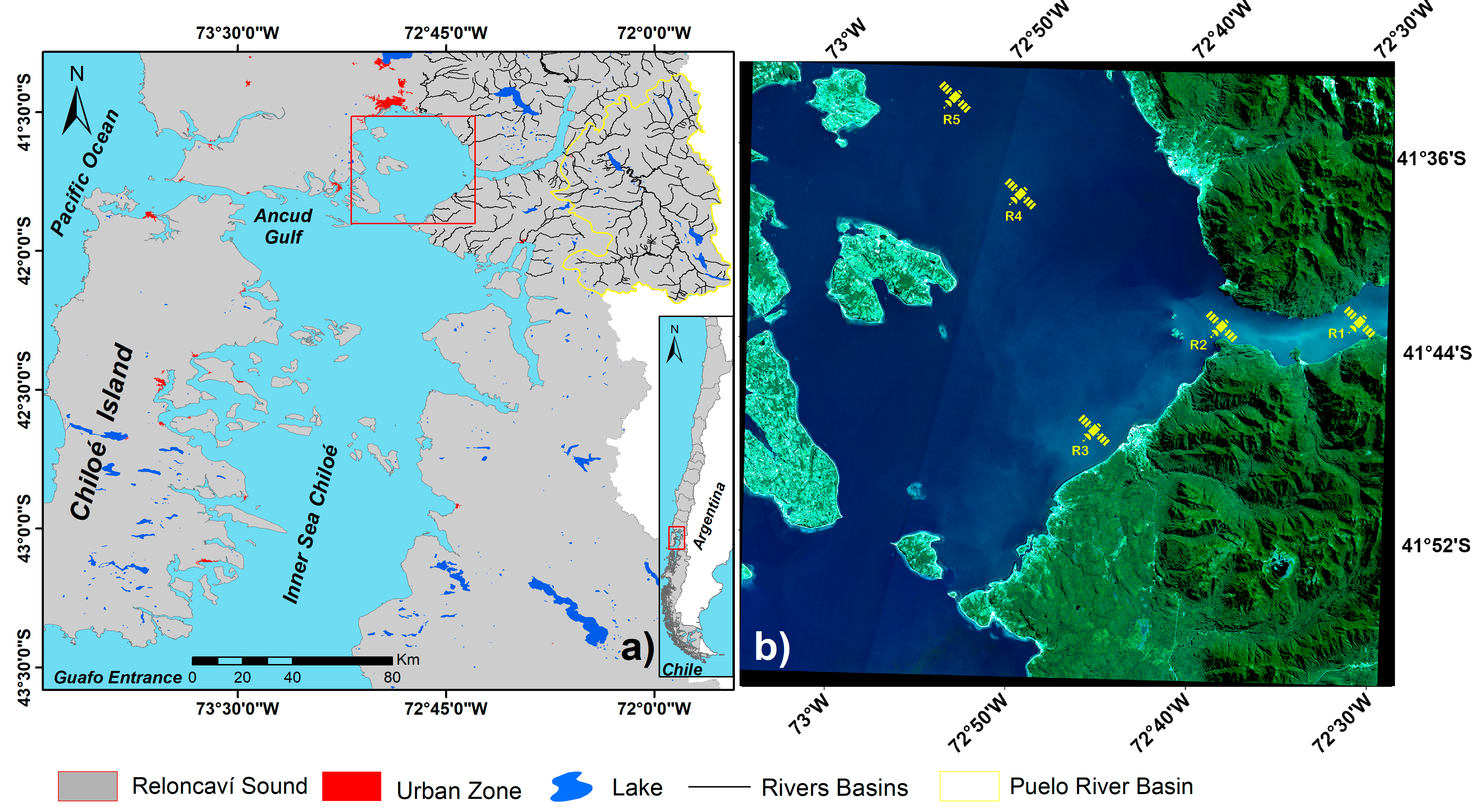
On the relevance of the topic, it should be stressed that two activities are being carried out within Reloncaví. high economic importance for Chile, which are salmon farming and mussel crops.
Read more » Sign agreement to improve the monitoring of mussel farming
"It is an important area for both industries in the country. View how they behave these variables correspond not only to the field of remote sensing and marine ecology, but also to study the impact and effects of murky waters on species benthonic and pelagic, including bodies dependent on photosynthesis and those who feed by filtration, for example," he added.
Seasonal exposure to turbid waters may disturbing or altering the state and growth behavior of organisms over time. "In particular, in their early stages of life. If you collect variables over time, you can linking processes the behavior of organisms in the area and in different disciplines", he concluded.
- PRESS HERE to see the full study in Science Direct.
*Image: courtesy of UCSC.